original article published February 15, 2022 by the Tri-City Voice
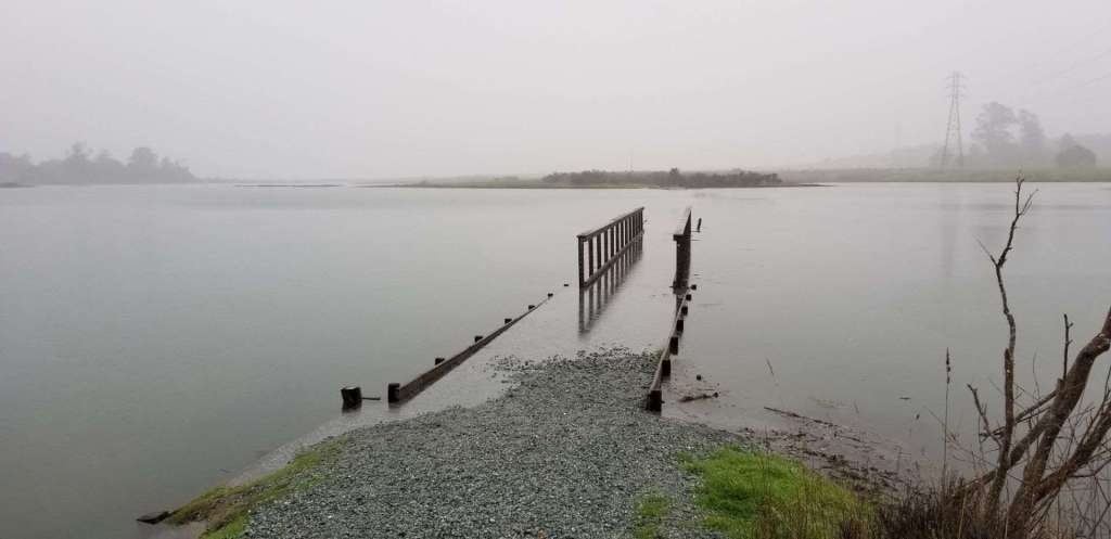
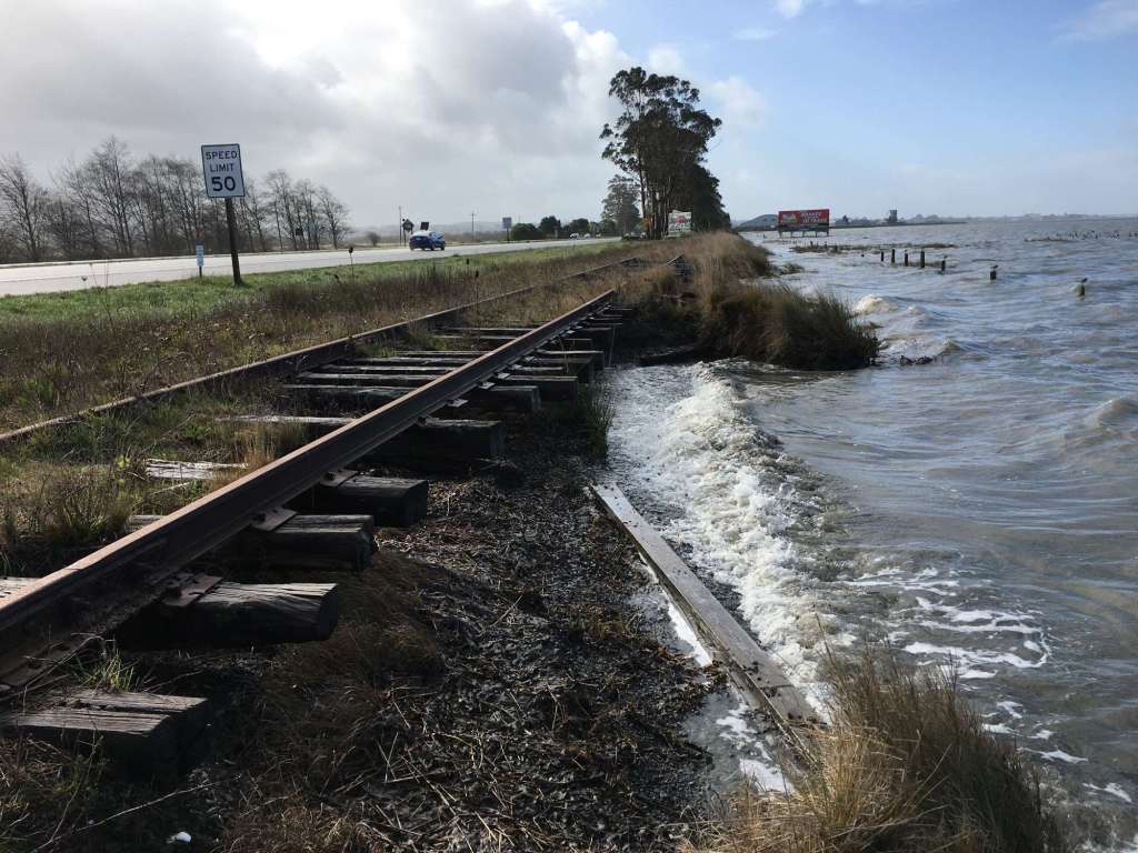
The sea is rising.
This isn’t just a tale as old as time, or a sailor’s myth, or political rumor. It is, in fact, a scientifically documented reality. Along with other impacts of climate change, like massive out-of-control wildfires and long, extended droughts, this is now our “new normal” that we must come to accept.
In their first meeting of the year, the Alameda County Board of Supervisors took an important step in acknowledging that our planet is changing by approving Supervisor Otto Lee’s resolution to join the Bay Adapt Joint Platform (BAJP), a call to action to address sea level rise in the Bay Area.

Said Supervisor Lee, who represents an area of Santa Clara County most at risk from rising tides, “There are more than 80,000 housing units and 20,000 acres of wetlands at risk by 2040. Starting off the year by adopting the BAJP is the necessary action we need to save families and their homes. I am grateful to my colleagues for unanimously adopting the BAJP. This is one of the many steps we need to take in 2022, but this is a big one.”
Supervisor Lee also sits on the San Francisco Bay Conservation and Development Commission (BCDC), the prime organization (along with a host of community partners) responsible for developing the BAJP over the past few years. Said Lee, “The BAJP is a roadmap for how we can adapt faster, better, and especially more equitably to a rising Bay.”
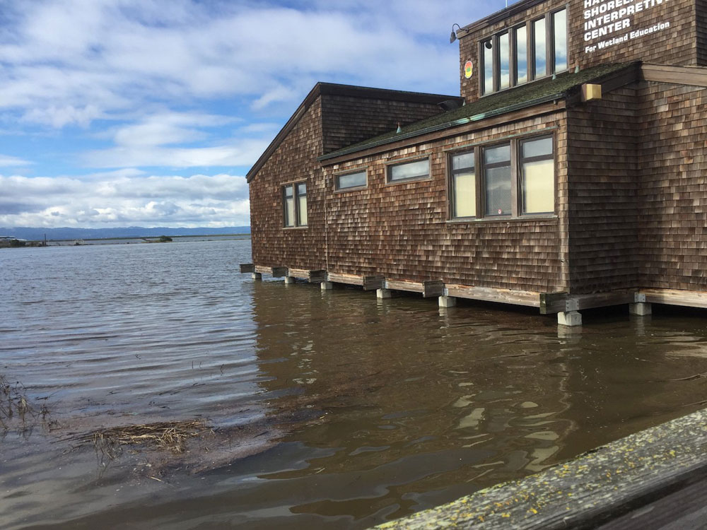
According to the National Oceanic and Atmospheric Administration (NOAA), the oceans have risen 8-9 inches since 1880, and the rate of sea level rise has been accelerating throughout the twentieth century. In many locations throughout the U.S., high-tide flooding is now 300-900% more frequent than it was 50 years ago. This is due mostly to global warming – a combination of melt water from glaciers and ice sheets and the thermal expansion of seawater as it warms.
Scientists estimate a rise of an additional 12 inches by 2100 in a best case scenario. In a worst-case scenario, a rise of over 8 feet by 2100 cannot be ruled out. It mostly depends on the rate of future carbon dioxide emissions. It’s no longer a question of “will there be sea level rise?”, but where and by how much.
The first ever regional study of sea level rise in the Bay Area was recently completed by Adapting to Rising Tides (ART), a program developed by the BCDC and NOAA’s Office for Coastal Management. According to the report, “No matter where you live, shoreline flooding from rising sea level and storm events will impact everyone in the Bay Area. Even if your home is far from the shoreline, the roads, rails, and ferries we rely on; the schools, childcare, and hospitals we depend on; the jobs at which we work; and the beautiful natural areas we love are at risk.”

The study goes on to say, “With rising sea level, permanent inundation will impact the entire bay shoreline at once. This is very different than how we experience storm flooding today, with big events like King Tides impacting parts of the bay shoreline very differently, or wildfires occurring only in certain parts of the region.”
Areas at risk of flooding include contaminated former industrial sites, critical services such as water, wastewater, electricity, and communication sites, transportation hubs, housing, recreational areas, and environmentally sensitive habitats.
While individual cities and counties are making efforts to stem the tide, as it were, a coordinated regional approach like the BAJP can prevent problems that arise from local initiatives, such as disproportionate impacts to disadvantaged communities, delays due to other concerns like housing and transportation, and impacts to jobs and business. According to the BAJP, “no one agency, jurisdiction or community can or should do it alone.”
The strategy of the BAJP has been reduced and simplified into 9 actions and 21 tasks, which include everything from accelerating the regulatory approval process to educating students on how to adapt to climate change to prioritizing nature-based construction projects. It’s a herculean effort that will involve hundreds of organizations and thousands of people in a concerted attempt to save our way of life.
For an interactive map that shows which areas of the Bay are most vulnerable to sea level rise, visit ART’s Bay Shoreline Flood Explorer: https://explorer.adaptingtorisingtides.org/home
Photo Credit: King Tides Project
For more information:
SupervisorLee.org
http://www.adaptingtorisingtides.org

